
ΑΙhub.org
Detection of marine litter using deep learning
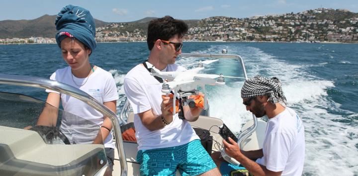
Researchers at the University of Barcelona have developed an open access, deep learning-based web app that will enable the detection and quantification of floating plastics in the sea with a reliability of over 80%.
Floating sea macro-litter is a threat to the conservation of marine ecosystems worldwide. According to UNESCO, plastic debris causes the deaths of more than a million seabirds every year, as well as more than 100,000 marine mammals. Eroded fragments, known as micro-plastics, are now prevalent across the food chain. The largest density of floating litter is found in the great ocean gyres (systems of circular currents) with litter being caught and spun in these vast cycles. However, there is also much polluting waste in coastal waters and semi-closed seas, such as the Mediterranean.
To help understand the extent of the problem, researchers used more than 3,800 aerial images of the Mediterranean coast in Catalonia to train a convolutional neural network (CNN) model to recognise plastic litter. They have produced an application based on the R Shiny package, which you can access here. Using this app, it is possible to classify images individually, as well as to divide them into several segments, and to estimate litter density. The work was published in the journal Environmental Pollution.
The researchers hope that their work will enable progress in the assessment of the presence, density and distribution of plastic pollutants in the seas and oceans worldwide.
Previously, the most common method for assessing the prevalence of marine litter has been direct observations from boats or planes. However, the vast ocean area, and associated amount of data, mean that monitoring studies have been limited.
“Automatic aerial photography techniques combined with analytical algorithms are more efficient protocols for the control and study of this kind of pollutant”, notes Odei Garcia-Garin, first author of the article. “However, automated remote sensing of these materials is at an early stage. There are several factors in the ocean (waves, wind, clouds, etc.) that harden the detection of floating litter automatically with the aerial images of the marine surface. This is why there are only a few studies that made the effort to work on algorithms to apply to this new research context”.
“The great amount of images of the marine surface obtained by drones and planes in monitoring campaigns on marine litter – also in experimental studies with known floating objects – enabled us to develop and test a new algorithm that reaches a 80% of precision in the remote sensing of floating marine macro-litter”.
In their future work, the team plan to adapt the app to further automate the process: this would involve automatic classification of images obtained directly from remote sensors, such as drones.
Find out more
Automatic detection and quantification of floating marine macro-litter in aerial images: Introducing a novel deep learning approach connected to a web application in R
Odei Garcia-Garin, Toni Monleón-Getino, Pere López-Brosa, Asunción Borrell, Alex Aguilar, Ricardo Borja-Robalino, Luis Cardona, Morgana Vighi.
The MARLIT GitHub page can be found here.
tags: Focus on life below water, Focus on UN SDGs


